
NEWS
UN ADOPTS HISTORIC RESOLUTION TO CORRECT AFRICA’S DISTORTED PLACE ON WORLD MAPS

The United Nations General Assembly has adopted a landmark resolution encouraging the international community to embrace a new world map that more accurately reflects the true size of Africa and other continents.
The initiative, popularly known as Correct the Map, was spearheaded by Togo and backed by members of the African Union. A total of 164 countries supported the resolution, including the United Kingdom and France, while the United States voted against it and six countries abstained.
Although the resolution is not legally binding, supporters believe it could trigger a major rethink of the centuries-old mapping system used in classrooms, government institutions, media organisations and other parts of the world.
At the centre of the debate is the Mercator projection, a world map created in 1569 by Flemish cartographer Gerardus Mercator. Originally designed primarily to assist European sailors with navigation, the projection has remained one of the world’s most widely recognised representations of the planet.
But there is a major problem.
On the Mercator map, Africa can appear surprisingly similar in size to Greenland. The reality is dramatically different: Africa is approximately 14 times larger than Greenland.
The discrepancy is a consequence of the way the Mercator projection translates the Earth’s curved surface onto a flat map. While the system preserves direction and makes navigation easier, it dramatically enlarges areas closer to the poles while shrinking regions around the equator.
This means countries such as Canada, Russia and Greenland appear far larger than their actual landmass, while Africa and other equatorial regions appear significantly smaller.
The result has sparked decades of criticism from cartographers, educators and campaigners who argue that a map can influence more than geographical understanding, it can shape perceptions of the importance and scale of entire regions.
In an effort to address these distortions, cartographers developed the Equal Earth projection in 2018. Unlike the Mercator projection, Equal Earth is designed to preserve the relative size of continents and countries more accurately.
The African Union’s 54 member states adopted the Equal Earth projection in February, promoting it as a more realistic representation of the world’s continents, particularly Africa.
Togo subsequently took the campaign to the United Nations, arguing that correcting the world’s map is also about correcting perceptions of Africa.
The country’s Foreign Minister, Robert Dussey, has maintained that a fairer representation of the planet begins with a fairer map, stressing that geographical representations can influence how people understand the position, scale and importance of different continents and populations.
France has also thrown its weight behind the initiative. French Foreign Minister Jean-Noël Barrot announced that his ministry would discontinue its use of the Mercator projection, arguing that changing the map would not alter the world itself but would correct a historically distorted representation of it.
Campaigners believe the implications go well beyond geography.
Lerato Mogoatlhe of Africa No Filter has linked the traditional representation of Africa to broader narratives about the continent, arguing that its visual minimisation contributes to misconceptions that have persisted for generations.
Kenyan geographer Kioko Muendo has similarly pointed out that maps can influence perceptions of Africa’s enormous landmass, population, resources and economic potential.
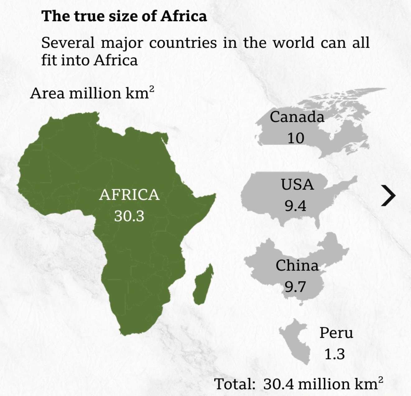
The #CorrectTheMap campaign has sought to make Africa’s enormous scale easier for the public to understand by demonstrating what could fit within the continent.
According to the campaign’s comparison, Africa is large enough to accommodate the United States, China, India, Japan, Mexico and much of Europe, while still leaving considerable land area.
The comparison has become one of the campaign’s most powerful arguments because it exposes just how misleading conventional world maps can be when viewers judge countries and continents by their apparent size.
Despite the overwhelming international support, the initiative has not escaped criticism.
The United States opposed the resolution, with its representative at the UN, Yaryna Ferencevych, arguing that the General Assembly should focus its attention on major global priorities, including international peace, prosperity and relations among nations, rather than revisiting a map created centuries ago.
The disagreement highlights the fact that the debate is not merely about cartography. It touches on questions of history, representation, education and how the world sees itself.
For supporters, replacing the Mercator projection is ultimately about correcting a visual imbalance that has shaped global perceptions for generations.
The Earth itself will not change because a different map is used. Africa will remain where it has always been, and Greenland will remain Greenland.
What could change, however, is how millions of people visualise the world.
The UN resolution therefore represents a symbolic victory for campaigners who believe that Africa’s true physical scale should be reflected more accurately in the maps used to educate, inform and shape public understanding around the globe.
The debate over the world’s map may have started centuries ago, but with the UN vote, the argument over how Af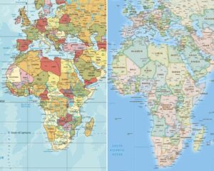 rica is seen by the world has entered a new chapter.