
NEWS
UN Adopts New World Map to Correct Africa’s Long-Standing Cartographic Distortion

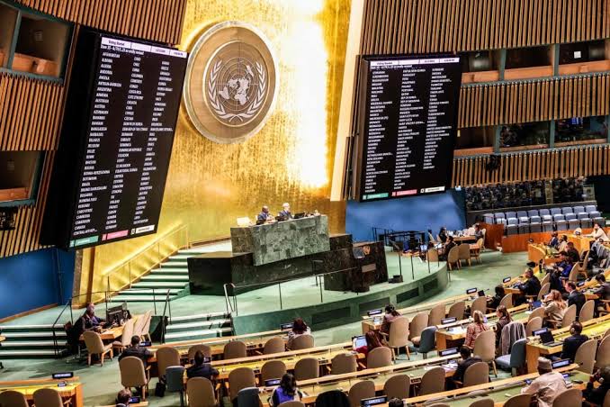
…as UN Votes To Adopt New World Map That Shows True Size Of Africa
The United Nations General Assembly has voted overwhelmingly to adopt a new world map projection that more accurately represents the actual size of Africa and other regions of the world, in what African countries have described as an effort to correct a centuries-old distortion in global cartography.
The decision followed a sustained campaign by African countries and advocates who argued that the widely used Mercator projection has for centuries presented a misleading picture of the relative size of continents, making Africa appear significantly smaller than it actually is.
Togo introduced the resolution before the UN General Assembly about a year after the African Union endorsed the initiative. The resolution forms part of the #CorrectTheMap campaign and is backed by all 55 member states of the African Union.
At the centre of the campaign is a push to replace the traditional Mercator projection with the Equal Earth projection, a modern map design that is considered to provide a more proportionally accurate representation of countries and continents based on their actual surface areas.
The resolution calls for an “equitable” representation of the different regions of the globe, with particular emphasis on Africa. Supporters say the issue goes beyond geography, arguing that the way the world has traditionally been portrayed on maps can influence how people perceive the importance, size and influence of different regions.
The Equal Earth projection was developed in 2018 and is designed to preserve the relative surface areas of countries and continents more accurately than the Mercator projection.
The difference becomes particularly striking when Africa is compared with Greenland. While the Mercator map, created in 1659, portrays Greenland as roughly comparable in size to Africa, Africa is in reality about 14 times larger than Greenland.
Historians and geographers have long criticised the Mercator projection, arguing that its distortions are linked to historical Western perspectives and stereotypes about the relative importance of different parts of the world.
Activists have also adopted the term “cartographic colonialism” to describe the argument that traditional map-making conventions have contributed to a distorted understanding of Africa and other regions.
How countries voted:
The resolution secured overwhelming backing at the UN General Assembly, with 164 member states voting in favour. Among those supporting the measure were Nigeria, Togo, Ghana, Morocco and 50 other African member states. Several major European and international powers, including Germany, France, Turkey and the United Kingdom, also voted in favour.
However, Estonia, Georgia, Lithuania, Moldova, Serbia and Ukraine abstained from the vote.
The United States voted against the resolution, with its representative describing it as “superfluous.”
Although UN General Assembly resolutions are not legally enforceable, meaning countries and institutions will not be compelled to use only the Equal Earth projection or prohibited from continuing to use the Mercator projection, the vote could have significant long-term implications.
Supporters hope the decision will encourage governments, educational institutions, technology companies and other organisations to reconsider how maps are produced and displayed. It could potentially lead to changes in classroom curricula, educational materials, digital mapping systems and other everyday technologies where the Mercator projection remains widely used.
Togo’s Foreign Affairs Minister, Robert Dussey, said the resolution was intended to acknowledge the disproportionate representation created by the Mercator projection and to encourage a more scientifically accurate understanding of the world.
“The discussion is not a political discussion [but] a scientific discussion, because there is scientific proof, so we all have to accept the reality,” he said.
Dussey further argued that the effects of the projection extend well beyond the appearance of maps, saying they have influenced how Africa and other parts of the world are perceived globally.
“The projection has had lasting cognitive, educational, cultural, geopolitical and socioeconomic effects, contributing to a drastic reduction in the perceived size of Africa and other regions of the world in the global collective imagination.”
France also backed the resolution before it was adopted, with Foreign Minister Jean-Noël Barrot saying the country was prepared to move away from the traditional projection.
“We will abandon the Mercator projection in favour of map representations tailored to specific uses, more faithful to actual surface areas and in line with the recommendations of cartographers and scientists.”
The UN decision therefore represents more than a change in the way continents are displayed on paper or digital screens. For its African proponents, it is part of a broader effort to challenge historical narratives and representations that they believe have shaped global perceptions of the continent for generations.
Previous UN vote on transatlantic slavery:
The development comes months after the UN General Assembly voted to recognise the transatlantic slave trade as the gravest crime against humanity, another resolution strongly championed by African countries.
Ghana introduced the resolution before the assembly, calling on UN member states to consider an apology for the transatlantic slave trade and the establishment of a reparations fund.
Ghana’s Foreign Minister, Samuel Ablakwa, said such funds would be directed towards addressing the enduring damage caused by slavery and supporting communities and individuals affected by its legacy.
“We are demanding compensation and let us be clear, African leaders are not asking for money for themselves. We want justice for the victims and causes to be supported, educational and endowment funds, skills training funds,” he said.
That resolution also received significant support, with 123 member states voting in favour.
However, the United States, Argentina and Israel voted against it, while 52 countries, including Britain, Portugal and Spain, abstained.
The issue gained further momentum when the UN Committee on the Elimination of Racial Discrimination (CERD) declared on Monday that countries were legally obliged to consider reparations for harms caused by the transatlantic slave trade.
The committee maintained that states continue to have obligations to address the lasting consequences of slavery under the current international legal framework, regardless of whether slavery and the slave trade were considered illegal under the laws that existed at the time.
“Irrespective of the legal characterisation of the original historical acts, States Parties remain bound by their present obligations under the Convention to address structural inequalities,” the UN Committee said.
Together, the developments have renewed debates over how Africa is represented, both physically on maps and historically in international institutions, as African nations push for greater recognition of the continent’s size, history and place in the global order.